


WEATHER
Weather: The conditions of the atmosphere which occur at a place at specific time period (from hour to hour or day to day) are known as weather.
Importance of weather:
- a) Good weather improves people’s lives
b) Weather determines the kind of clothing to be worn by people in an area.
- c) Knowledge of the weather of a place enables people to carry out economic activities which can be sustained by the weather in that place. e.g. dairy cattle do well in a cool and wet place.
- d) By studying the weather of a place over a long time, we can establish its climate.
Weather and Human activities
Most human activities affected by weather that is experienced at a place.For example, When the rains are heavy, flooding occurs and causes damage to crops, animals and infrastructure like roads. This means that few economic activities can take place.
When there is no rain, plants and animals die, rivers and streams dry up, and irrigation and other economic activities like fishing cannot be carried out. Therefore weather affects the social economic activities of a place.
Elements of Weather
Are the basic atmospheric condition of a place at a given time.
There are 7 element of weather
i) Sunshine
ii) Temperature
iii) Humidity
iv) Cloud cover
v) Precipitation
vi) Wind
vii) Atmospheric pressure
IMPORTANCE OF EACH ELEMENT OF WEATHER
i. Sunshine
Sunshine refers to the sun’s rays that reach the surface of the earth.
Importance of Sunshine:
- The sun’s energy enables plants to manufacture food through the process of photosysnthesis
- People need sunshine to dry their crops, food like cassava, millet, maize and fish
- They also use sunshine to warm themselves
Dries clothes after washing them
ii. Temperature
Refers to how hot or cold an object or place is.
The heat in the atmosphere is supplied by th sun
Importance of Temperature:
Warm is essential for plant and animal survival
Plants need warm in order to manufacture their fool
Facilitates formation of clouds
iii. Humidity
Is the amount of water vapor(moisture) in the atmosphere
There are two types of humidity:
a) Absolute humidity and
b) Relative humidity
a) Absolute humidity:
Is the actual amount of water vapor or moisture in a given volume of air at a particular temperature.
b) Relative humidity:
Is the ratio of the actual amount of water vapor or moisture in a given volume of air (i.e. absolute humidity) to the maximum amount of water vapor that the same volume of air can hold at the same temperature.
iv. Cloud cover
Clouds are masses of tiny droplets of water or ice particles or both which are suspended in the atmosphere.
They are formed when water vapor or moisture in the atmosphere cools and condenses.
Importance of cloud cover:
Are important because they condense to form rain and other forms of precipitation.
v. Precipitation
This refers as the fall or deposition of moisture water vapor or frozen water from the atmosphere onto the earths surface.
Importance of Precipitation:
ii. Temperature
Refers to how hot or cold an object or place is.
The heat in the atmosphere is supplied by th sun
Importance of Temperature:
Warm is essential for plant and animal survival
Plants need warm in order to manufacture their fool
Facilitates formation of clouds
iii. Humidity
Is the amount of water vapor(moisture) in the atmosphere
There are two types of humidity:
a) Absolute humidity and
b) Relative humidity
a) Absolute humidity:
Is the actual amount of water vapor or moisture in a given volume of air at a particular temperature.
b) Relative humidity:
Is the ratio of the actual amount of water vapor or moisture in a given volume of air (i.e. absolute humidity) to the maximum amount of water vapor that the same volume of air can hold at the same temperature.
iv. Cloud cover
Clouds are masses of tiny droplets of water or ice particles or both which are suspended in the atmosphere.
They are formed when water vapor or moisture in the atmosphere cools and condenses.
Importance of cloud cover:
Are important because they condense to form rain and other forms of precipitation.
v. Precipitation
This refers as the fall or deposition of moisture water vapor or frozen water from the atmosphere onto the earths surface.
Importance of Precipitation:
- All life on the earth is purely dependent on moisture provided through precipitation
- The importance of rain is that, rain provides water for plants to grow (i.e. water for irrigation, growth of grass and pasture depend on rain)
- Also animals too need water to drink and human needs for domestic and industrial uses.
Note:
Excess rain and rainstorms result in disasters due to flooding
vi. Wind
Wind is air in motion. It is made up of variety of gases, such as oxygen and carbon dioxide. Wind move horizontally from areas of high pressure to areas of low pressure.
Importance of wind:
- They are important in many aspects of weather for instance they cause flow of heat and moisture and their transfer from one point to another and are also responsible for the movement of clouds.
- Wind direction and wind speed or velocity are two important aspects in geography. Wind direction is important because it help us to understand characteristics of the particular winds in terms of temperature and moisture content.
- Wind speed or velocity determines wind strength or force and therefore determines weather conditions of a place. Example, When strong winds blow over a place, little or no rainfall will be experienced.
vii. Atmospheric Pressure
This is the force at a point on the earth’s surface due to the weight of air above that point. The atmosphere is the air surrounding earth’s surface and it has weight, which is force with which it presses down on a unit area. The weight of atmosphere on the earth’s surface and at sea level at 1033.3g/cm2
-Areas of very low pressure cause feeling of weightlessness and that is the feeling one gets when he or she is on top of a very high mountain like Mt Kilimanjaro.
-Areas under very low pressure may experience very strong winds periodically as air flows into such areas from high pressure regions.
WEATHER STATION
Is a place where the elements of weather are measured and recorded. Examples of the elements are temperature, humidity, pressure, rainfall, wind direction and speed, cloud cover, and sunshine.

STEVENSON SCREEN
A Stevenson screen is made to allow air temperature to be measured. It consists of a wooden box with louver sides in order to allow free air to enter inside. In order to prevent sun’s heat to reach inside, the roof is double bodied. The screen is painted white to improve insulation. The screen is then placed on a stand which is about 121 centimeters above the ground. Other instruments include rain gauge, wind vane, anemometer, barometer, hygrometer, and the camp-bell stokes sunshine recorder. Weather and climate affect the physical environments as well as human activities.

1. Temperature:
Temperature is the degree of heat of a body, measured by a thermometer and expressed in degrees of a centigrade or Fahrenheit scales. There are several types of thermometer which shows the highest temperature reached during a day and the minimum thermometer which shows the lowest temperature reached.
Maximum thermometer

The figure above shows the maximum thermometer with a metal index. Thermometer is made of glass and it contains mercury in a bulb. A mercury column extends from a bulb at one end of the thermometer along a fine glass tube. The length of the mercury column shows changes in temperature when temperature rises, the mercury expands and the length of the column increases, pushing along the metal index.
The maximum temperature is read from the side of the metal index nearest to the mercury. When the temperature falls the mercury falls , leaving behind the metal index still indicating the maximum temperature reached. A magnet is used to bring back the metal index into contact with the mercury.
Minimum thermometer
Minimum thermometer
The minimum thermometer contains alcohol instead of mercury. Alcohol is used because it has lower freezing point than mercury. Any fall in temperature will cause the alcohol column to contract and the meniscus (the curved upper surface of the alcohol column) will pull the index back along
the tube whenever temperature rises, the alcohol will expand and flow freely past the metal index without pushing it up. Therefore the metal index is always left as a record of the lowest temperature reached between the readings. The part of the metal index away from the bulb will indicate the lowest temperature reached.
the tube whenever temperature rises, the alcohol will expand and flow freely past the metal index without pushing it up. Therefore the metal index is always left as a record of the lowest temperature reached between the readings. The part of the metal index away from the bulb will indicate the lowest temperature reached.
.
Six’s thermometer

The six’s thermometer can also be used for measuring maximum and minimum temperature
The thermometer consists of a “U” shaped glass tube. The metal index nearest to the bulb indicates the minimum temperature and the other metal records the maximum temperature. When the mercury in the tube maximum temperature falls, the alcohol in the bulb contracts. This causes the mercury to push index B towards the bulb. The minimum temperature is read from the part of index B from the mercury.
Reading and Recording Temperature
Temperature reading is taken every day either at regular and fixed intervals (for example, after every four or six hours) or once in twenty four hours – In some meteorological stations temperature are recorded continuously by a self recording instrument called a thermograph. The maximum and minimum temperature which are recorded for a specific period of time are used to calculate
Daily range of temperature, which is the different between the maximum and the minimum temperatures.
The mean daily temperature which is the average of the maximum and minimum temperature. The monthly range of temperature which is the difference between the highest mean daily temperature and the lowest mean daily temperature in a month. The annual range of temperature in a year which is the difference between the highest mean monthly temperature and the lowest mean monthly temperature.
To get a mean temperature daily for a month of a particular year add the mean daily temperature and divide the total by the number of days in that month. The average monthly temperature of a place such as Dar es Salaam for January is obtained by adding all the mean January temperature for thirty years or more and dividing the sum by the same number of years. This mean monthly temperature is used to show the temperature condition of the place for January.
When mean monthly temperature for a given month are obtained for many places, they can be shown on a map. Lines are drawn to connect places with the same mean monthly temperature. These lines are known as isotherms.
Mean January temperature in 0f.


The way of presenting temperature data for a town is by using a graph. Mean monthly temperature figures for a year are plotted on the graph and points are joined by a smooth line.
Factors affecting temperature
Factors that affect temperature include: altitude, ocean currents, distance from the sea, latitude and prevailing winds.
· Altitude
Temperature decreases with an increase in altitude at the rate of 0.60c for every 100 meters. That is why the summit of Mount Kilimanjaro with 5895 meters above sea level permanently covered with ice.
· Ocean currents
Ocean currents are either warm or cold. Warm currents raise the temperature of wind blowing across them while cold currents lower temperature of such winds. Some winds blowing on shore will influence the temperature of such wind
s in some of coastal areas with the temperature of the ocean currents.
s in some of coastal areas with the temperature of the ocean currents.
· Distance from the sea
Distance from the sea affects temperature. This is because large areas of land masses lying at great distance from the sea do not get the moderating influence of the oceans. Lack of this moderating effects makes the land masses experience very low temperature in winter and very high temperature in summer. This extremely results in high annual range of temperature. The interior of the continent of Asia is a typical example.
· Latitude
The amount of heat received at any place depends on the angle at which the sun’s rays strike the surface of the earth and the duration of sunshine. At the equator the sun’s rays reached the earth’s surface at almost right angles. Throughout the year but the angle decreases as one move towards the poles (fig 3.8) Therefore temperature decreases with increase in latitude because the sun rays spread over a larger area and its heating effect decreases.
EFFECTS OF LATITUDE ON TEMPERATURE

2. Humidity
The sun’s heat causes water to evaporate from the surface of the ocean and other water bodies. to form water vapor in the atmosphere.
Humidity is the amount of water vapor in air. Or
Humidity is the amount of water vapor in air. Or
Humidity is the state of the atmosphere in relation to the amount of water vapour it contains. Humidity indicates the degree of dampness of the air and it is one of the main influences on weather. It is expressed in either absolute or relative terms.
Absolute humidity, expressed in grams per cubic meter, is the actual amount of water vapour present in a certain volume of air at a given temperature. Relative humidity is the amount of water vapour present in a mass of air expressed as a percentage of the total amount of water vapour that would be present when that air is saturated at the temperature. Air is saturated when the atmosphere cannot hold any more water vapour. This condition depends on the temperature and pressure of the air.
Humidity is measured by a hygrometer which consists of wet and dry bulb thermometers. The wet bulb thermometer is kept moist (wet) by wrapping it in a Muslin which is then dipped in a container of distilled water.

When the air is not saturated water evaporates from the muslin and cools the wet bulb. The cooling effect causes the mercury to contract. The dry bulb is not affected in the same way as wet bulb because it does have a Muslin wrapping. It is affected by the surrounding air. So when the air is not saturated the two thermometers show different readings, when the air is saturated the two thermometers show the same readings.
Therefore when there is a big difference in reading between the two thermometers humidity is low and when there is small difference humidity is high.
Therefore when there is a big difference in reading between the two thermometers humidity is low and when there is small difference humidity is high.
Exercise
1. Define the following terms:
a) Climate : Is the average weather condition of an area recorded over a long period of time ( over 30 year)
b) Weather station: Is an established area where daily records of weather are done accurately.
c) Temperature: Is the degree of heat of a body.
d) Maximum thermometer: Is used to show the highest temperature
e) Minimum thermometer: Used to show the lowest temperature
f) Humidity: Is the state of the atmosphere in relation to the amount of water vapour it contains.
(i) Absolute humidity: Is the actual amount of water vapour present in a certain volume of air at a given temperature
(ii) Relative humidity: Is the amount of water vapour present in a mass of air.
(iii) Weather: Is the condition of the atmosphere which occurs at place at a specific period of time (FROM HOUR TO HOUR OR DAY TO DAY).
2. Mention seven elements of weather and their instruments
i) Temperature-Thermometer
ii) Humidity-Hygrometer
iii) Precipitation- Rain gauge
iv) Clouds- Human eyes
v) Winds-Wind vane, anemometer
vi) Sunshine- Camp bel, Stokes sunshine recorder
vii) Pressure- Barometer
3. The records of maximum and minimum thermometers are used for;
i) Daily range temperature which is the difference of maximum and minimum thermometer.
ii) Daily temperature which is the average between maximum and minimum temperature.
4. How can you obtain the following;
a) Daily range temperature : Difference between maximum and minimum temperature.
b)Mean daily temperature : The average between maximum and minimum temperature.
5. Lines draws on a map to connect places with the same mean monthly temperature are known as Isotherms
6. Temperature data are presented by using Graph
7. List down five factors affecting temperature
i) Altitude
ii) Ocean currents
iii) Distance from the sea
iv) Latitude
v) Prevailing winds
3. Precipitation:
Precipitation refers to the deposition of moisture from the atmosphere on the earth’s surface. It includes dew, frost, snow, mist and hail, sleet and rain.
Dew:
Is the water vapor that condense on solid objects when the dew is reached.The droplets formed after condensation of water vapour which is then deposited on the cool surface such as building, leaves, grass and stones.
Is the water vapor that condense on solid objects when the dew is reached.The droplets formed after condensation of water vapour which is then deposited on the cool surface such as building, leaves, grass and stones.
Frost:
Frost is a tiny ice crystals deposited on objects on the ground, frost is formed when temperature falls below freezing point.
Frost is a tiny ice crystals deposited on objects on the ground, frost is formed when temperature falls below freezing point.
Snow:
snow is the frozen droplets of water, snow formed when water vapour in the atmosphere turns into crystals of ice and reach the ground before melting.
snow is the frozen droplets of water, snow formed when water vapour in the atmosphere turns into crystals of ice and reach the ground before melting.
Mist:
mist refers to tiny water droplets suspended immediately above the ground. Frost is similar to mist but it is denser with less visibility.
mist refers to tiny water droplets suspended immediately above the ground. Frost is similar to mist but it is denser with less visibility.
Hail:
Hail is the form of precipitation falling with small ice blocks, sleet is a mixture of snow and rain. It forms when the temperature of the ground is lower than the temperature above.
Hail is the form of precipitation falling with small ice blocks, sleet is a mixture of snow and rain. It forms when the temperature of the ground is lower than the temperature above.
Rain:
Rain are the droplets of water falling from the atmosphere after condensation. When water vapour rises, It cools at high altitude until dew point is reached. Dew point is the temperature rate at which the atmosphere is saturated with water vapour. Condensation takes place after dew point has been reached to form water droplets. These droplets combine to form larger drops which fall as rain.
Rain are the droplets of water falling from the atmosphere after condensation. When water vapour rises, It cools at high altitude until dew point is reached. Dew point is the temperature rate at which the atmosphere is saturated with water vapour. Condensation takes place after dew point has been reached to form water droplets. These droplets combine to form larger drops which fall as rain.

TYPES OF RAINFAL
a) Convectional rainfall
When rain is formed through vertical rising of moist air currents it is called convectional rain

Convectional currents arise due to differential heating of the earth’s surface. Convectional rains are common in the tropical areas.
b) Relief rain
Sometimes moist winds are forced by a high mountain to rise and when they reach high altitude the moisture in them condenses to form droplets, which fall as rain.
Rain formed in this way is called relief or orthographical rain.

The sides of the mountain facing the direction of the winds is known as the wind ward side while that which faces away from the direction of the wind is known as the lee wards side or the rain shadow, the lee ward side gets very little rain . A typical example of rain shadow in Tanzania is found in the western side of mountain Kilimanjaro, winds blow from the Indian Ocean in the east and are forced by this mountain to rise and drop most of their moisture on the eastern and south eastern slopes. When these winds blow to the western side of the mountain they already relatively dry.
c) Cyclonic rain
When large masses of air with different characteristics of temperature and moisture, cyclonic rain may occur. As the warm and moist air is forced up over the cool and dry air, it expands. At higher altitude the warm air cools and water vapour condenses to form clouds and rain.
On the other hand tropical cyclones are formed over oceans is the tropical between latitude 80N and 80S. They usually bring very heavy rainfall and are associated with thunderstorms and very fast moving wind, which often causes destruction along coastal settlements . In the Caribbean and U.S.A tropical cyclones are called hurricanes in Africa they are known as cyclones and in China and Japan they are called typhoons.

Rainfall is measured by using a rain gauge. The rain gauge consist of an outer case , a copper-receiving vessel, a funnel whose diameter is normally 13 centimeters, a clear glass jar or bottle and a graduated measuring cylinder.

Normally reading is done once every 24 hours. If necessary comments on the nature, time and duration of rainfall should be added to the record. Mean monthly rainfall for a station is usually obtained by adding up rainfall records of a particular month (say January) for a number of years (say 30 years) and dividing the total by the same number of years.

The figures so obtained can be presented in the form of graphs known as histogram. Figures for different places are plotted on a map and places with the same amount of rainfall are joined by smooth line. The line joined places with the same amount of rainfall are known as Isohyets

Mean Rainfall In Bukoba

Rainfall Variation.
Rainfall variation is a normal phenomenon on the earth which is caused by a number of factors. Some of them include Ocean currents, distance from the equator, prevailing winds, water bodies, nature and shape of the coast, distance from the sea, altitude and human activities.
Ocean Currents.
There are two types of Ocean Currents. The warms and the cold currents. The warm Ocean Currents yield rainfall over the adjustment land. This is because the winds cross over them do carry large amounts of moisture for example Mozambique current. Much rainfall is experienced along the East Coast of Africa.
Cold ocean currents are crossed by wind which have no moisture, hence brings very little or no rain in the adjacent land. For example banguera currents in south-west Africa coast and the canary current in the north-west coast of Africa.
Distance from the equator
Areas along the equator receive more rain than areas away from it. This is because of high amount of solar radiation, which result into evaporation and raising of air moisture hence condensation takes place resulting into convectional rainfall. Congo basin and Brazil are few examples which receive much rainfall due to their position.
Prevailing winds.
Winds blowing from the land towards the sea (off-shore) are carrying moist air from the land and yield no rainfall except in the sea. These winds usually lead to dryness of the land with very low rains in the coast. Effects of these winds are development of deserts. Eg, the Sahara Dessert in the North of Africa.
Lack of water bodies.
Areas with large water bodies such as areas around lake Victoria receive much rain than areas without water bodies like central Tanzania and North Eastern Kenya. Water bodies increase much rain to adjacent areas.
Nature and shape of the coast.
The coastal areas, which align parallel to the prevailing wind such as the N.E trade winds move parallel with the North Eastern Coast of Kenya, yield no rainfall. As result a dry climate is experienced along the coast.
Distance from the sea.
The areas near the sea or ocean experience high rainfall due to winds blowing moisture from the sea which would cause rainfall to the coastal areas. Areas that are very far from the sea receive very little or no rainfall for example, Dar es Salaam in Tanzania and Mombasa in Kenya receive heavier rains than Dodoma, Singida and Tabora, which have long distance from the Indian Ocean.
Altitude.
Altitude is also a factor for uneven distribution of rainfall, highlands force the warm air to rise over them. When they condense, they cause rain to fall on the wind ward side. The other side of the highland (leeward) may receive very little or no rainfall at all. People of such areas includes the eastern part of South Africa receives heavy rain (orographic) while the Western part experiences prolonged droughts due to effects of Drankensburg mountains. The eastern part of East Africa also receives heavier rainfall than the western side due to warm moist winds blowing from the Indian Ocean.
Human activity.
Besides other environmental benefit plants or trees intercept precipitation and return moisture to the air through transpiration and evaporation. This process becomes balanced when there is no destruction of the vegetation. Human activity such as settlement, animal rearing, farming and transportation however can cause rainfall variations on the earth’s surface through land degradation. When people cut trees or clear the bushes, land is naturally destroyed.
The destruction of vegetation disturbs evaporation, condensation and precipitation process, which are necessary elements of rainfall. In turn the amount of precipitation in the air is interrupted either by causing floods or droughts. The California desert in U.S.A and the Sahel in Africa are the results of droughts caused by human activities, which have led to the expansion of the deserts in the 1980s.
RAINFALL EFFECTS
Too much rainfall for example, the case of Elnino (1998) results into negative impacts on life and properties. Heavy rainfall may cause destruction of houses, roads and bridges, crop and loss of life for both human and animals. In addition to the loss of life and property, floods, which are the results of heavy rainfall results into eruption of diseases such as malaria, cholera, and dysentery.
On the other hand, too little rainfall leads to little yield of food and cash crops. Famine and hunger in the parts of the world is a result of lack of rainfall.
Prolonged dry seasons in some parts of the world have resulted into the loss of lives of both animals and the people. North Eastern Kenya, Somalia, Sudan, and Ethiopia are some of the areas where people and animals have lost their lives because of long droughts.
Prolonged dry seasons in some parts of the world have resulted into the loss of lives of both animals and the people. North Eastern Kenya, Somalia, Sudan, and Ethiopia are some of the areas where people and animals have lost their lives because of long droughts.
Rainfall reliability leads to continuous crops production and animal keeping hence improves standard of living and the industrial development of a nation may be realized. Sustainable agriculture is made possible and people are assured of enough food and cash crops.
Pressure.
The air surrounding the earth’s surface from the atmosphere. The atmosphere has weight. The force with which it presses down on a unit area is called atmospheric pressure. The pressure is exerted equally in all directions. To demonstrate that atmospheric pressure is exerted equally in all directions one can do the following experiment.
· Take a glass with full of water.
· Cover the top of the glass with a piece of thin paper
· Hold the glass upside down.
Atmospheric pressure is measured by an instrument called a barometer. There are two types of barometer, mercury barometer and aneroid barometer. A mercury barometer is a simple apparatus consisting of a glass of about 9.2 centimeters long and bowl filled with mercury.
The glass tube is filled with mercury and being put upside down in the bowl of mercury. At sea level the mercury will fall until the column is about 76 centimeters above the surface of the mercury in the bowl. A vacuum is left at the top of the tube. To read the pressure centimeter rule is placed besides the glass tube and the change in height of the mercury column gives the reading of the atmospheric pressure. Mercury barometers are not portable.
Barometer

Another instrument commonly used is the aneroid barometer. It consists of an air fight box of thin metal containing very little air. The top of this box moves inwards and outwards with changes in atmospheric pressure. This movement is transmitted by a system of levers to a circular seal with a pointer which shows the reading of atmospheric pressure.
Pressure is expressed in millimeters with reference to the height of mercury column or in millibars. A bar is the standard unit of pressure measurement. It is divided into one thousand units called millibars. At sea level pressure is one thousand millimeters of mercury or 1.5 kilograms of force per square centimeters. This is equivalent to 1013.2 millibars approximately one bar.
Lines joining places with the same pressure are called isobars and the pressure is greater at sea level where the whole thickness of the atmosphere exert its weight. Pressure decreases at the rate of 10 millibars for every 100 meters increase in height because the thickness of the atmosphere decreases.
Pressure
1. What is pressure?
Pressure is the air surrounding the earth’s surface forms the atmosphere.
2. Define atmospheric pressure – Is the force with which atmosphere presses down on a unit area
3. Atmospheric pressure is measured by a barometer
4. Two types of barometers are;
a) A mercury barometer.
b) Aneroid barometer.
5. Pressure is expressed in millimeter.
6. A bar is the standard unit of pressure measurement
7. It is divided into one thousand units called millibars.
8. Lines joining places with the same pressure is called isobars.
9. Mention three roles of pressure in human life.
a) Partial filling of tires hinders proper movement of the vehicle.
b) Pressure is also helpful to the patients whose parts of body fail and pump blood to other parts of the body.
c) Other pressured things include the decoration balloons and playing…
10.Pressure decreases at the rate of 10 millibars for every 100 meters
WINDS
Wind is air in motion from high pressure to low pressure area.
SEA BREEZE(DAY)

LAND BREEZE(NIGHT)

During the day the land is usually warmer than the sea, and the air pressure on the land is lower than that over the sea. Therefore winds blow from sea to land. These winds are known as sea breezes. During the night the land is cooler than the sea and there is low pressure on the sea. Therefore winds blow from land to sea, these are called land breezes.
There are great variations in the general patterns of wind systems in areas of the earth’s surface where there are large land masses adjacent to large water bodies. During summer, intense low pressure develops in central Asia in the Northern hemisphere and winds blow inform of high pressure over the Indian and pacific oceans.
July wind pattern

During winter, intense high pressure develops in central Asia while intense low pressure develops over the Indian Ocean causing winds to blow from the land to the ocean. Such winds that reverse their direction with changes in seasons are called monsoon winds. The word monsoon is derived from an Arabic word “mausin” which means season.

January breeze
In the equatorial belt of low pressure between 5oN and 50S, intense solar heating causes the moist air to rise in great convention currents. This belt is called the doldrums or low pressure belt. The rising air spreads out and moves towards the poles. In so doing it cools and sinks from a high pressure belt. This take place around latitude 300N and, these latitudes are called horse latitudes or subtropical high pressure belts.
In latitudes 300N and 300S some of the high pressure air moves the surface towards the equator as the north- east and south-east trade winds, and some of it moves over the surface towards the poles as the western. Cold air blowing from the poles southwards and northwards expand and its pressure falls. These low pressure belts become noticeable around latitude 600N and 600S. As air moves away from the poles most of it moves in from higher levels to take its place. Thus in each hemisphere there are three winds systems; One operates between north poles and latitude 600N and between the south poles and latitude 600S (polar winds) and a second one operates between latitude 300N and 600N and between latitude 300S and 600S (the westerly winds).

Wind belts of the world
Occasionally in the westerly wind system depressions and anticyclones develop. A depression is an area of low pressure in which winds blow a circular motion. This motion is anti-clockwise in the Northern hemisphere but clockwise in the southern hemisphere. A depression develops when cold heavy air comes into contact with warm moisture. A depression is usually associated with cyclonic rains. Anticyclones are areas of high pressure in which winds blow in a clockwise circular motion in the Northern hemisphere. They normally follow a depression and are associated with cool fine weather with no rain.
Wind direction is measured by a wind-vane. A wind-vane consists of a freely rotating arrow fitted to a central rod. The arrow of the wind-vane always points to the direction from which winds blows, and the wind is named after this direction. Four arms marking the directions of the cardinal points are fixed to the stationary central rod.
Wind- vane

Wind speed is measured by an instrument called an anemometer. This instrument consists of three or four horizontal arms that when there is wind the arms rotate. This movement operates a meter which records the speed of the wind in kilometers per hour.
Anemometer

Weather forecasting
Weather forecasting is defined as a prediction of weather condition of a place at a given time approximately 24 + 48hrs. Weather forecasting is obtained through two methods namely, traditional and modern methods.
The traditional method pred
icts weather through observation of types of birds voices, crocking of frogs, rainbow, migration of birds, changes of wind direction, position of the moon and general body feeling. The method is still widely used in predicting weather by the indigenous communities.
icts weather through observation of types of birds voices, crocking of frogs, rainbow, migration of birds, changes of wind direction, position of the moon and general body feeling. The method is still widely used in predicting weather by the indigenous communities.
Modern method involves the use of modern equipment such as satellites, electronic computers, radar, and aircraft, balloons, ships, submarines, rockets and daily records from weather stations. This method of predicting weather is more reliable and accurate.
METHODS AND INSTRUMENTS USED FOR WEATHER FORECASTING (MODERN METHODS)
1. Radiosonde
This is an instrument used to register pressure and temperature from the ground to roughly 12km above the ground. The instruments are fixed to balloons filled with helium gas and are released into the atmosphere every day at a particular time from different weather stations. The radiosonde transmits radio signals to computers on the ground station where they are analyzed. The signal transmitted give pressure, temperature and humidity readings at different altitude. These balloons are made in such a way that they burst when they reach a certain altitude.
2. Satellite
The satellite used for predicting weather are human made space. They move around the earth so that they can provide various types of information. They are also used in radio, television and telephone communication. Satellite transmits photographs on weather conditions on a daily basis. The movement of clouds can be predicted from an analysis of the movement of winds force period of 24hours.
3. Persistence method
This is simpler way of making a weather forecast. It assumes that the atmosphere conditions of a place at the time of forecast will not change. For example, if it is 28°C in Dodoma today the persistence method predicts that it will still be 28°C in Dodoma tomorrow. If two inches of rain fell in Arusha yesterday, this method predicts that two inches of rain will fall in Arusha today.
4. Statistical forecasting
In this method, meteorologists ask themselves how is the weather usually like at this time of the year?. They then collect records of average temperatures and rainfall over the last five years. This give forecasters an idea of what the weather is “supposed to be like” at the certain time of year.
METHODS AND INSTRUMENTS USED FOR WEATHER FORECASTING (MODERN METHODS)
1. Radiosonde
This is an instrument used to register pressure and temperature from the ground to roughly 12km above the ground. The instruments are fixed to balloons filled with helium gas and are released into the atmosphere every day at a particular time from different weather stations. The radiosonde transmits radio signals to computers on the ground station where they are analyzed. The signal transmitted give pressure, temperature and humidity readings at different altitude. These balloons are made in such a way that they burst when they reach a certain altitude.
2. Satellite
The satellite used for predicting weather are human made space. They move around the earth so that they can provide various types of information. They are also used in radio, television and telephone communication. Satellite transmits photographs on weather conditions on a daily basis. The movement of clouds can be predicted from an analysis of the movement of winds force period of 24hours.
3. Persistence method
This is simpler way of making a weather forecast. It assumes that the atmosphere conditions of a place at the time of forecast will not change. For example, if it is 28°C in Dodoma today the persistence method predicts that it will still be 28°C in Dodoma tomorrow. If two inches of rain fell in Arusha yesterday, this method predicts that two inches of rain will fall in Arusha today.
4. Statistical forecasting
In this method, meteorologists ask themselves how is the weather usually like at this time of the year?. They then collect records of average temperatures and rainfall over the last five years. This give forecasters an idea of what the weather is “supposed to be like” at the certain time of year.
Weather forecasting is useful to people in the following ways;
a) Farmers planning their work for a year. This is because weather broad casting helps farmers to adjust their farming activities to suit the expected weather conditions.
b) Weather broadcasting greatly influence transport since it helps sailors and air travelers to know condition of the winds.
c) Helps in planning sport activities.
d) Helps in selecting suitable clothes.
e) Helps fishermen to plan their fishing activities.
f) Helps contractors to plan for a suitable houses.
g) Helps in geographical expeditions like tours and military.
h)Military personnel benefit from weather broadcasting as they can plan their military activities depending on weather conditions
Exercise
1. If the temperature at Dar- es-salaam, which is at sea level, is 32oc, the temperature at a place where altitude is 1,500 meters will be
a) 0.60c
b) 230c (C)
c) 80c
d) 170c
2. Circle the letter of the correct response for the following statements.
To obtain the mean monthly temperature of a place for a month in a particular year, take
a) The sum of mean daily temperature for the month.
Number of days in the month.
b) The sum of the monthly temperature x12
Numbers of days in the month.
c) The sum of the monthly temperature for the year
12 months
d) The daily maximum + the daily minimum
2.
3) Study the Temperature graph for Delhi below and answer the following;
a) Which is the coldest month?
b) Which is the hottest month?
c) Calculate the annual range of Temperature.
CLIMATE
Is the average weather condition of an area recorded over a long period of time (over 30 years). The weather elements listed above are measured and recorded at a weather station. A weather station is an established area where daily records of weather are done accurately. Each weather station should have the following instruments; Thermometers which are kept in Stevenson screen that is maximum thermometers, minimum thermometers (six’s thermometer), dry bulb thermometer and wet bulb thermometers
THE MAIN DIFFERENCES OF WEATHER AND CLIMATE
WEATHER | CLIMATE |
1. Is the condition of the atmosphere of a place at a particular time over a short period of time | -Is the average weather conditions of a region which have been observed over a long time |
2. Weather varies from one place to another within a region | -Climate remains uniform overa large region |
3. Weather changes abruptly within a short period | -Climate change is slow, gradual and occurs over many years |
4. There are weather instruments for measuring most of the elements of weather | -Climate elements are not measured but calculated from the weather measurements |
Major Natural Regions of the World
Temperature on the earth’s surface varies from place to place. Place near the Equator usually have high temperatures throughout the year, while places near poles are cold throughout the years, similarly different areas on the earth’s surface receive different amounts of rainfall.
A place in South American, which gets the same amount of rainfall as a place in West Africa and has similar temperatures, will have the similar natural vegetation.
Temperature on the earth’s surface varies from place to place. Place near the Equator usually have high temperatures throughout the year, while places near poles are cold throughout the years, similarly different areas on the earth’s surface receive different amounts of rainfall.
A place in South American, which gets the same amount of rainfall as a place in West Africa and has similar temperatures, will have the similar natural vegetation.
Likewise, people who live in the two areas under the same natural conditions carry out similar economic activities, for example, farming.
A region with the same geographical background to human activity such as temperature, rainfall and natural vegetation, is called a natural region, on this basis the earth’s surface may be divided into the following natural regions;
1. 1. Equatorial Region.
2. 2. Tropical Grasslands (Savanna).
3. 3. Monsoon Region.
4. 4. Hot Deserts.
5. 5. Mediterranean.
6. 6. Warm Temperature Eastern Margin (China type).
7. 7. Warm Temperature Interior Region (Steppe type.)
8. 8. Cool Temperature West Coast Margin (British type).
9. 9. Cool Temperature Continental Regional (Siberian).
10. Cold Temperature Eastern Margin (Laurentian)
11. Tundra and Polar Regions.
12.. Mountain Regions.
10. Cold Temperature Eastern Margin (Laurentian)
11. Tundra and Polar Regions.
12.. Mountain Regions.
The Equatorial Region
The equatorial region is found approximately between latitude 00 and 50 North and South of the equator. Areas which belong to this type of natural region are the Amazon and Congo basins, the West Africa Coast, the East Indians and the Coastal plain Colombia.

High temperature and very heavy rainfall characterize the region. The temperature varies little from 270c throughout the year. The annual range of temperature is generally small about 20c throughout the year. The total rainfall in these regions is around 2,000 millimeters with no distinct dry season. The annual distribution of rainfall usually shows two peaks (maximal) after the equinoxes fig 4.3, 4.4 and 4.5 and table 2(a) ,(b) and (c) demonstrates the climate of this region.

YAOUNDE

Singapore

Belem
Table 2: Typical climate figures for the equatorial Region.
a) Yaounde (Cameroon)
Month | J | F | M | A | M | J | J | A | S | O | N | D | Yearly |
Temp 0C | 25 | 25 | 24.6 | 24.5 | 24.2 | 24 | 24 | 24 | 24 | 24 | 24.4 | 24.5 | 24.3 |
Rainfall mm | 40.6 | 68.6 | 150 | 230 | 206 | 114 | 64 | 84 | 194 | 226 | 150 | 50.8 | 1579 |
b) Singapore
Month | J | F | M | A | M | J | J | A | S | O | N | D | Yearly |
Temp 0C | 25.5 | 25.5 | 26.1 | 26.7 | 27.2 | 26.7 | 26.7 | 26.1 | 26.7 | 26.7 | 26.1 | 25.6 | 26.1 |
Rainfall mm | 246 | 180 | 185 | 198 | 65 | 178 | 170 | 198 | 175 | 201 | 256.5 | 264 | 2415.5 |
c) Belem (Brazil)
Month | J | F | M | A | M | J | J | A | S | O | N | D | Yearly |
Temperature 0C | 25.5 | 25 | 25 | 25.5 | 25.5 | 25.5 | 25.5 | 25.5 | 26.1 | 26.1 | 26.7 | 26.1 | 25.5 |
Rainfall mm | 198 | 337.8 | 431.8 | 352.1 | 279.7 | 231.1 | 58.4 | 71.1 | 15.2 | 12.7 | 15.2 | 66 | 2275.8 |
Rainfall in this region is of the convectional type and is usually accompanied by thunder and lighting. Heavy rainfall, high humidity and high temperatures throughout the year result in continuous growth of vegetation’s. The natural vegetation in this region is thick forest called salve. The forest is always green, because the trees do not shed their leaves at the same time. The most common trees are mahogany, rosewood, ironwood, green heart balsa, palms and tree ferns.
The trees can grow to a height of 45 meters and their umbrella-like tops from and almost continuous cover of tree crowns (canopy). The trees are often intertwined with creepers (Lianas) and have many parasite plants. Because little light reaches the ground hence there is little undergrowth, where man has cleared the forest and practiced shifting cultivation, deserted areas develop secondary forests with mainly small trees and thick undergrowth.
There are three types of animals found in the equatorial rain forests. The first type consists of tree dwellers such as the gorilla, the chimpanzee and the monkey. These animals have long arms, which enable them to swing from branch to branch. In additional to these animals there are many varieties of birds, reptiles and insects. The second type consists of those animals which live in the rivers, such as the hippopotamus and the crocodile. The third type comprises animals that dwell in the open parts of the forest, especially where the forest merges into the Savanna.
People living in the equatorial regions usually engage in shifting cultivation or “slash and burn” agriculture. In this type of cultivation the people clear the forest by cutting down and burning the vegetation, then they tilt the soil and grow crops such as yams, cassava, groundnuts, maize, millet, sweet potatoes, sorghum, beans, water melon and banana. The major type of people in Amazon and Congo basin and East Indians are engaged in this kind of agriculture. They also do some hunting and fishing.
Another agriculture activity found in the equatorial region is plantation agriculture. A plantation is a large scale farm in which cash crops such as natural rubber, cocoa and oil palms are grown. Most rubber plantations are found in Malaysia, Indonesia, Thailand and Sri-Lanka. Natural rubber are of great importance to the economy of Malaysia and Thailand. It was equally important in the economy of Indonesia before oil was discovered. Rubber is used in making tires and in the manufacture of many industrial products.
Oil palm is another important crop grown in equatorial regions. It is grown in Nigeria, Malaysia and Indonesia. Palm oil is produced from the flesh of the fruit and from the nut. Palm oil is used for the manufacture of margarine, cooking fat and soap.
In Nigeria oil palm cultivation is widely spread in the South. The palm belt yields more palm produce than all the other parts of West Africa put together. The palm belt has ideal condition for growing palm. It has heavy annual rainfall about 1500mm, enough sunshine for opening the palm fruits, and well drained soils. Over 90% of the produce is obtained from small hold farmers, while the rest is obtained from plantations. Oil is extracted from the nuts by manual method or in oil mills.
Cocoa was introduced to the West Africa mainland from Fernando Po Islands in the last part of the 19th century. It has been developed by peasant farmers. At the beginning, the quality of cocoa was very poor as a result of lack of new technology in the preparation of the beans for export. Great improvements have been achieved following the grading of the cocoa beans and the payment attached to each grade. Ghana is the leading cocoa producing country in the world, with an annual output of about 250,000 tons.
A piece of land can be kept under cocoa cultivation for as long as 40 years. Preparation of the farms is done between January and March. Food crops are also grown on the cocoa farms during the first 4 years when the cocoa trees have not started to bear fruits.
Cocoa seedlings are easily damaged by directly sun rays and heavy rain. That is why a few trees are left when clearing the bush so that they may provide shades. More shades are provided by planting bananas.
Flowering begins in December and the main cocoa harvest takes place between October and February and the “light crop” is gathered from April to August. During the main harvest, owners of large cocoa farms are usually forced to hire labours to gather and tend upon the beans during fermentation. The quality of the crop depends largely on proper fermentation.
At home, men use sticks to split open cocoa pods. Inside each pod there are about forty beans lying in a bed for sticky white pulp. Women separate the beans from the pulp. Children help to carry them to the markets that are close to railway stations. From the markets the cocoa beans are transported by rail to Accra for export.
(Ghana Main cocoa producing area)

Lumbering in Ghana.
Ghana is among the west African countries that fall under equatorial type of climate. One of the economic activities carried in Ghana is lumbering. The forest and woodland used to cover about 33.1% of the total land use in Ghana. Up to date the forest land remaining is only a quarter of the former land. This is due to high exploitation of forests without replacement, which encourage expansion of deserts and soil degradation. Forest management is under government control, which involves both natural forest and timber plantations.
The government encourages timber production for export which employs about 70,000 people in the timber industry. A national Forestry Administration Program (NFAP) was established, supported by international bodies like USAID, the FAO and the countries such as Canada and the United Kingdom. Such programs do not realize the government’s irresponsibility in conserving the forests but to people who clear forests for new areas of farms land.
The falli
ng of trees is through both man labour and use of machines. The trees are cut into logs and packed on the trucks then transported to the ports for export, and other to the home industries for processing. A part from lumbering people obtain traditional medicines, firewood, fruits and meet through hunting. These benefits are not realized by the government.
ng of trees is through both man labour and use of machines. The trees are cut into logs and packed on the trucks then transported to the ports for export, and other to the home industries for processing. A part from lumbering people obtain traditional medicines, firewood, fruits and meet through hunting. These benefits are not realized by the government.
Tropical Grassland (Savanna or Sudan).
These regions are found between 50c and 200c north and south of the equator. They include West Africa, Sudan, East and Central Africa, the Brazilian plateau, Venezuela and North Australia.
Tropical Grassland or Sudan type

Temperatures are always high, but with a greater range than in the equatorial region. They range from 200C during the cool season and 320c in the hot season. This region has an annual range of temperature of about 80c. Total rainfall mainly during the hot season of the year (Tables 3 (a) and (b) and figure 4.9 and 4.10)
|

|

The vegetation varies considerably from the areas near the equatorial forest to the desert margin. The grass are tall and trees are more numerous in regions near the equatorial forests, but towards the desert margins the grass is short and poor and there are scattered thorn bushes. The grass grows well and becomes green during the rainy season but it turns yellow during the dry season. The grassland is known as the Campos while those in Venezuela are called the llanos. The African and Australian grasslands are known as the Savanna. The Savannas are the most extensive grasslands.
Table 3: Typical climate figures for the Tropical Grassland (Sudan type) Region.
a) Cuiba (Brazil)
Month | J | F | M | A | M | J | J | A | S | O | N | D | Yearly |
Temp 0C | 27.2 | 27.2 | 27.2 | 26.7 | 25 | 23.9 | 24.4 | 25.5 | 27.8 | 27.8 | 27.8 | 27.2 | 26.7 |
Rainfall mm | 248 | 211 | 211 | 101.6 | 53 | 7.6 | 5 | 28 | 50.8 | 114 | 149.9 | 205.7 | 1386.6 |
(b) Bulawayo (Zimbabwe)
Month | J | F | M | A | M | J | J | A | S | O | N | D | Yearly |
Temp 0C | 21.7 | 21 | 20.6 | 18.9 | 16.0 | 13.9 | 13.9 | 16 | 20 | 22.2 | 22.2 | 22.2 | 19.2 |
Rainfall mm | 149.7 | 101.6 | 78.7 | 17.8 | 0 | 0 | 0 | 2.5 | 22.9 | 83.8 | 132 | 599.4 |
Typical trees of the Savanna grasslands are baobabs, miambo, acacias and gum trees. Two main groups of animals found in the Savanna include the grass and leaf eating animals such as giraffe, elephant, buffalo, hippopotamus, zebra, antelope and rhino. Animals which feed entirely on plants are known as herbivorous animals.
The second group consists of the fresh eating or carnivorous animals such as the lion, leopard and hyena. In addition, there are many species of birds, Reptiles and insects.
People in the tropical grassland engage mainly in livestock keeping and cultivation. In the Campus of Brazil, cattle are grazed on large farms called ranches. Cattle rearing is also important in the llanos of Venezuela and Savannas of Africa.
The main crops grown in the tropical grasslands are maize, millet, groundnuts, rice, beans, onions, cotton, tobacco, sugarcane, sisal and coffee. Maize and millet are the two most important food crops. Maize grows well in the wet areas while millet thrives in the drier parts. Groundnuts are important crops in West Africa. In Brazil and other tropical high land, coffee is grown mainly on plantations. Cotton is widely grown throughout the tropical grassland on small peasant plots.
Most of Tanzania lies in the tropical grassland. In this part of the country livestock keeping is one of the major occupations of the Sukuma and the beans are growing mainly for food by the majority of Tanzanians. Coffee, Cotton, Tobacco are grown in various parts of the country as cash crops.
Cotton Growing in Sukuma land
Cotton is one of the important cash crops in Tanzania. Over 90% of the outputs comes from areas around Lake Victoria, specifically Mwanza and Shinyanga regions. These are usually referred to as Sukumaland and it is inhabited by Sukuma tribe. Other areas together produce about 10% of the country’s total output.

Cotton production 1990-1999

Cotton growing in sukuma land started in Mwanza and Kwimba districts, and later spread into the surrounding areas of shinyanga, Maswa and Geita. These new areas had a small population but a lot of flat land. This made large scale cotton farming possible. People also grow cassava, maize and rice mainly for subsistence.
In sukuma land rainfall is seasonal and has great influence in cotton growing. Both the total annual rainfall, which is between 508 millimeters and 884 millimeters, and the monthly distribution are of great importance to the quality and quantity of cotton produced.
Table 4. Rainfall Data: Average Monthly totals
Month | Station | ||
Geita (Boma station) mm | Maswa Banagi Hill station mm | Maswa ( Gulu Station) | |
October | 85.80 | 30.75 | 8.64 |
November | 136.91 | 75.18 | 43.94 |
December | 122.43 | 88.14 | 99.82 |
January | 101.6 | 75.95 | 100.84 |
February | 884.58 | 78.23 | |
March | 121.16 | 116.59 | 119.63 |
April | 156.21 | 119.63 | 85.34 |
May | 87.63 | 61.72 | 37.59 |
June | 11.18 | 30.99 | 0.00 |
Jully | 1.02 | 24.38 | 0.00 |
August | 42.93 | 0.00 | |
September | 32.00 | 35.56 | 0.64 |
Total | 1752.97 | 780.05 | 594.99 |
GRAPHS

Generally Mwanza Region has an altitude varying from 1,128 meters to 1,280 meters. Suitable land for growing cotton in Mwanza area occurs in patches in the up lands partly because there is a lot of rocky land in this area and partly because the bottom lands are more suitable for grazing. In Mwanza region cotton fields are usually cultivated by family members. They cultivate the farm in strips down the slopes around the hills.
Shinyanga region has been more recently settled than Mwanza region. Cotton farms in this area are quite extensive because the land is flat and the farmers use tractors or plough and hire labour during weeding and harvesting peaks. Geita district is the only district in Mwanza region which engages in extensive farming similar to that found in Shinyanga region.
Labour patterns in both Mwanza and Shinyanga regions follow a similar sequence. For example, a generalized working p
attern in Geita district in Mwanza and that of Maswa district in Shinyanga is as follows;
attern in Geita district in Mwanza and that of Maswa district in Shinyanga is as follows;
Activity | Geita- (Mwanza) | Masura (Shinyanga) |
1. First significance cultivation | Early October | Late November |
2.Cultivation peak | Late November | Late December |
3. Weeding peak | Early January | Early February |
4. Harvesting peak | Mid June | Early July |
· In Maswa farmers generally begin to cultivate soon after the first rains. Their working calendar on the cotton farms is as follows;
November- Mid December
· Clearing the fields.
· Ploughing and spreading manure or fertilizer.
· Collecting seeds from primary societies (about two and a half tons per hectare).
· Planting.
Mid December- March
· Thinning the seedlings.
· Weeding (done three to four times).
· Spraying (done three to four times).
May – July
· Harvesting
· Sorting and grading
June – August
· Selling.
August – September
· Uprooting and burning the cotton plants. Most farmers do the ploughing and planting at the same time at the beginning of the rainy season.
Weeding is done at least three times. The first weeding is done when the cotton seedlings are seven to ten centimeters tall. This helps the seedling grow healthy and strong because they get enough supply of food and in clean fields. The second weeding is done before the cotton balls open and spraying is done after each weeding to clear off any cotton disease.
The harvesting period is the busiest time for the whole family, usually harvesting is done between May and July. The beginning and the end of harvesting will depend on when each individual farmer planted his cotton. But harvesting peaks occur between the last week of June and the first week of July. After harvesting peaks occur between the last week of June and the first week of July. After harvesting, Farmers immediately uproot the cotton plants and burn them. Burning help to kill the cotton pests that might have attacked the cotton plants. The farms are left clear of any cotton plants ready for the next ploughing period.
Livestock Raising in Tanzania.
Livestock raising in Tanzania include pastoralism, mixed farming and ranching. Pastoralism is an activity of keeping animals such as cattle, goats and sheep’s. The pastoralists in Tanzania include the Masai and Barbaigs who move from one place to another searching for pastures and water for their animals. Normally they don’t have permanent settlements. These are pure pastoralists with large herds of animals.
Ranching is a commercial way of keeping animals. The animals are kept in an enclosed big area with necessary facilities. Ranches in Tanzania involve beef cattle, piggery and large poultry projects. Some of these ranches can be found in Kongwa District in Dodoma, Kikombo in Mpwapwa District. Ruvu in Kibaha District and west Kilimanjaro in hai District. The government or companies today run most of these ranches.
Mixed farming is a kind of farming whereby people with permanent settlement keep animal and involve in crop cultivation. Good examples are the Sukuma, Nyamwezi and Gogo. Few cattle herders in Tanzania practice transhumance that is seasonal movement with cattle up to the highlands and down the valleys especially during dry seasons. The good examples of such movements are the pare who move with herds to the uplands during a day time and back to their homes in the evening.
Exercise.
Draw a map of Tanzania and show the areas with large number of animals keepers

Monsoon Region
It was pointed out that the word monsoon comes from an Arabic word “Mausin” which means season. The monsoon region is an area in the climate mainly influenced by the wind blowing alternatively from one direction in one season and the other direction in another season. The areas which have monsoon type of climate are South East (India, Pakistan, Burma, Thailand and China) and Northern Austria. This type of climate is mostly marked in India.

In winter, th
e interior of Asia is extremely cold. The air over this area is cold and heavy, forming a region of high pressure without blowing winds. But the sea is comparatively warm, for it has been gradually gaining at during summer and warm air over it rises, forming a region of pressure. Wind blows from the high pressure area in the interior towards the low pressure area over the sea. Since the winds which blow from land are dry, the monsoon lands receive little rain during winter except for it in coastal areas and island such as sri-lanka which are reached the winds after passing over the ocean. In summer the opposite happen. Except for very high areas, the interior of Asia becomes extremely cold. The air over the land becomes intensively heated, expand, rises and form a region of low pressure. Since the sea takes longer to heat than land does, the sea becomes comparatively cool, and forms an area of high pressure. Winds blow from the sea to the land and bring rain to South East Asia. Over most India Rain bearing winds blow from the south west. In china South East winds blow from the Pacific ocean.
e interior of Asia is extremely cold. The air over this area is cold and heavy, forming a region of high pressure without blowing winds. But the sea is comparatively warm, for it has been gradually gaining at during summer and warm air over it rises, forming a region of pressure. Wind blows from the high pressure area in the interior towards the low pressure area over the sea. Since the winds which blow from land are dry, the monsoon lands receive little rain during winter except for it in coastal areas and island such as sri-lanka which are reached the winds after passing over the ocean. In summer the opposite happen. Except for very high areas, the interior of Asia becomes extremely cold. The air over the land becomes intensively heated, expand, rises and form a region of low pressure. Since the sea takes longer to heat than land does, the sea becomes comparatively cool, and forms an area of high pressure. Winds blow from the sea to the land and bring rain to South East Asia. Over most India Rain bearing winds blow from the south west. In china South East winds blow from the Pacific ocean.
The amount of rainfall the monsoon region receives varies from place to place. For instance, charrapunji, on the wind ward side of the khusi hill in Assam (India), gets around Delhi (India) receives only 620 millimeters of rainfall (Table5 (a), (b) and (c) and fig. 4.17, 4.18 and 4.12.
Table 5: Typical climate figures for the Tropical Monsoon Region;
a) Bombay ( India)
Month | J | F | M | A | M | J | J | A | S | O | N | D | Yearly |
Temp 0C | 23.8 | 23.8 | 25.5 | 26.8 | 29.2 | 22.4 | 26.4 | 26.3 | 26.3 | 27 | 26.1 | 26.3 | 26.1 |
Rainfall mm | 2.5 | 0.0 | 2.5 | 17.8 | 523 | 693 | 406 | 299 | 60 | 10 | 0.0 | 2016.7 |
b) Darwin (Australia)
Month | J | F | M | A | M | J | J | A | S | O | N | D | Yearly |
Temp 0C | 28.9 | 27.8 | 28.9 | 29 | 26.7 | 26 | 25.1 | 26.1 | 28.1 | 29.7 | 29.8 | 29.5 | 28.1 |
Rainfall mm | 388.6 | 330.2 | 246.4 | 114 | 17.8 | 5 | 2.5 | 2.5 | 12.7 | 53.3 | 132 | 261 | 1554.5 |
c) Hong Kong
Month | J | F | M | A | M | J | J | A | S | O | N | D | Yearly |
Temp 0C | 15.4 | 14.3 | 17.2 | 21.1 | 25 | 26.1 | 26.7 | 26.7 | 26.1 | 24.4 | 20.6 | 17.2 | 22.2 |
Rainfall mm | 35.6 | 27.9 | 66 | 139.7 | 259 | 383.5 | 289.6 | 355.6 | 292.1 | 114.3 | 40.6 | 33 | 2169.5 |
The monsoon region has three marked Season. The hot dry season starts from March to June and has temperatures rising to over 320c, hot wet season which starts from October to March. Fig 4.17, 4.18 and 4.19 Show rainfall and temperature conditions for three stations in the monsoon region
|

|

Hongkong
There is very little of the natural vegetation left in the monsoon areas. However, the main natural vegetation types still existing vary with the amount of rainfall. Where there is very heavy rainfall (over 2000mm) vegetation consists of forests with trees such as teak and tropical cedar, .the trees grow to a height of about 30 to 35 meters. Where rainfall is relatively heavy (1000-2000mm) less dense forests are found. The trees include iron, wood and sandal wood. Mangrove trees grow in swampy coasts and many reaching a height of nine meters. Deciduous any trees such as tamarack and acacias are another type of vegetation found in this region. This vegetation is found in their desert of India. Because of population pressure in India, a lot of land which is reserved for wild animals have been used for human settlement. As a result of luck of natural habitats many wild animals have disappeared. Among the animals that have survived are the tigers, the hyenas, and the elephants
About 70 percent of the population in Asia are farmers. Because of the high density of population in many parts of Asia most farms are small in size and are intensive. Rice is the most common food crop and is the staple food for most people in the wetter parts of India, Bangladesh, Burma and indo- china. Wheat, millet, maize and sorghum are grown in the drier areas where rice cannot be grown, and are important crops in the northern India and Pakistan. Sugarcane, cotton and jute are important in lower land crops in India, Pakistan and Bangladesh. Tea is grown in highland areas as a plantation crop particularly in Sri-lank, Bangladesh and India.
Pigs, cows, buffaloes, sheep, goats and poultry birds are raised in this region. India has a large number of cows but a cow is regarded as a sacred animal by the Indians and it is therefore not kept for meat. Cattle is kept for milk and for ploughing. Large urban centers in the region have developed as major industrial centers.
Paddy growing in India.
Rice is the staple food to the people of India. It is grown in the tropical lowland where rainfall exceeds 1780mm per year. it is the most characteristic crop of the monsoon lands and the total coverage exceeds that of any other crop. Paddy is cultivated in very few areas outside the influence of the monsoon.
The factors for paddy growing include heavy rains which exceed 1780mm per year. The alluvial type of soil brought by rivers and ice melt from the Himalayas increase fertility to the soil. Water logging in the flooded areas is also another factor for paddy growing, the additional water through irrigation from the Punjab irrigation schemes, wells and canals increase yielding of paddy in India. In areas with less amount of rainfall below 1780mm allow growing of paddy where as the wet paddy is grown in the heavier amount of rainfall.
The land holding is for subsistence and plantation. The subsistence is mainly for family consumption where excess is sold to the rural cooperatives. The farmers use oxen borrowed from the land owners or cooperatives to plough the paddy field and harvest by hand using seasonal cheap laboures. In the plantations, they use tractors and often oxen to plough the paddy fields. The tractors are owned by the government and foreign companies. They apply fertilizers and insecti sides to improve high yields of the crop. In harvesting they use seasonal or migrant laboures and combined harvesters. A large part of the harvest is for selling.
The Hot Deserts
Hot deserts are found on the western margins of land masses between latitude 200 and 300 north and south of the equator (fig.4.20). hot deserts occupy about one third of the earth’s surface. The major hot deserts of the world are, the Sahara, the Kalahari and the Namibian deserts in Africa, the California deserts( north AMERICA), the Alabama desert(south America), the Arabian, thar and Gobi deserts in Asia and the great Australia desert.

The desert surface varies from desert to desert and from place to place within the same desert. On the basis of types of surfaces deserts are classified as:
1. Sand deserts these have sand surfaces and are sometimes known as ergs.
2. Stony deserts where stones prevail. Such deserts are also called series or regs.
3. Rocky deserts (Hamada) which have rocky surfaces. Hot deserts have high temperatures and very low rain fall (fig. 4.21, 4.22, and tables a,b, c.)
Table 6.typical climatic figures for hot dessert regions.
a) Insalah (Algeria)
Month | F | M | A | M | J | J | A | S | O | N | D | Yearly | |
Temp 0C | 13.3 | 6.1 | 20.0 | 25 | 28.9 | 35 | 36.7 | 35.8 | 32.8 | 26.7 | 19.1 | 14.4 | 23 |
Rainfall mm | 2.5 | 2.5 | 0 | 0 | 0 | 0 | 2.5 | 0 | 0 | 5.0 | 2.5 | 15.0 | 50 |
B) Lima (Chile)
Month | J | F | M | A | M | J | J | A | S | O | N | D | Yearly |
Temp 0C | 21.7 | 22.8 | 22.8 | 21 | 18.9 | 16.7 | 16 | 16 | 16 | 16.7 | 18.9 | 21 | 18.9 |
Rainfall mm | 0 | 0 | 0 | 0 | 0 | 5 | 7.6 | 12.7 | 12.7 | 2.5 | 0 | 0 | 45.7 |
b) Windhoek (Namibia)
Month | J | F | M | A | M | J | J | A | S | O | N | D | Yearly |
Temp 0C | 23.3 | 22.8 | 21.1 | 18.9 | 15.6 | 13.3 | 12.8 | 15.6 | 18.9 | 20.6 | 22.2 | 23.3 | 19 |
Rainfall mm | 68.6 | 68.6 | 81.3 | 43.2 | 10.1 | 0.0 | 0.0 | 0.0 | 2.5 | 10.1 | 25 | 45.7 | 256.5 |
In most deserts, day time temperatures are very high around 400C. Nights are cold with temperatures as low as 160C. In winters the night temperatures may fall to 500C. The daily range of temperatures is large (160C) for example in Egypt the mean monthly temperature in summer is 320C in winter months the temperature may be as low as 160 C.( table 6 figure 4.21,4.22 and 4.23)
|

|

|

Deserts get very little rain usual less than 250mm. in some deserts rain may fall only once in five or six years.This type of rainfall is heavy and collects into stream of running water which may form channels. When sub channels are dry they are called wadis.
In some cases for example in the Sahara strong winds such as harmattan blow across the desert. These winds carry a lot of sand and dust. Such sandstones are usually called simoom.
Natural vegetation is very scanty in hot deserts and it consists mostly therny scrub bushes and cactus. Wherever agriculture is practiced the crops that are grown include date palm, cotton, rice, sugarcane ,vines, millet, tomatoes , tobacco and fruit trees. Apart from people who live in these Oases there are nomads who move from place to place to search for pastures. They keep camels, donkeys, and sheep. Other desert people get their food from hunting and collection of nuts and fruits. Other occupations include weaving mats, making tents and ropes and also trading.
Meaning of desert:
Desert refers to an area which receive low amount of rainfall approximately 250mm per year.
Meaning of desert:
Desert refers to an area which receive low amount of rainfall approximately 250mm per year.
Life in the oasis.
In the deserts wherever there are oases some forms of settlements is bound to follow. These are depressions of varying size when underground water reaches the surface for example tufted oasis in morocco covers 13000 square kilometers which supports many settlements, including big towns. Other oasis include ghadermes oasis in Libya which is only 2.6 Square kilometers in size and supports a very low population.
Life in an oasis is very secured and well organized. A wall usually constructed around the oasis to keep out the violent storm dusts called simooms. In the oasis people live in mud bricks houses with flat roofs closely packed together. The streets are narrow and winding (run around the oasis). The heart of the settlement is dominated by the suas May (normal market place), mosques, schools and shopping blocks. Suas may also be set up several kilometers from anywhere and people come from a number of surround settlement on special days to trade.
Around the settlement is the agricultural land. Most of the crops produced are through irrigation channels or drawn water from wells by camels or mules. The important crops include date palm, others are maize, barley, wheat, cotton and sugarcane, fruits and vegetations.
Importance of deserts to the economy.
Desserts are important for the production of date palms, cotton, sugarcane and wheat which are raw materials to the world’s industries. Useful animals are also reared in the deserts and they walk long distances without eating and drinking. They serve people in transport all over the world as they are the cheapest means of transport. These animals include camels and mules. Valuable minerals deposits (Mining) are found
in the deserts for example gold, caliche (cemented groves), copper, sodium nitrate, silver, diamond and uranium which are very important raw materials in the world’s industries for different purposes.
in the deserts for example gold, caliche (cemented groves), copper, sodium nitrate, silver, diamond and uranium which are very important raw materials in the world’s industries for different purposes.
Apart from the above mentioned minerals, oil production and the desert. Most of the petroleum used in the world is obtained from deserts. Petroleum serves as lubricant as fuel for road construction and domestic uses and as raw materials in oil refined industries.
Desert formation expansion and control.
Desserts are formed by both man’s activities and natural forces, that influence desert formation which include drought which is a result of long experiences of low amount of rainfall or caused by man’s activity which is made more acute by population increase.
Population increase encourages deforestation for various reasons. Over grazing, use of unskilled labour, irrigation and over occupation. Desert expansion can be checked through changing people’s attitude by planting trees after cutting one, use of proper methods of irrigation, reducing the number of animals in one area avoid mono cropping by crop rotation and control population that exceeds resources available.
Revision.
Answer all questions in this section.
Read the following statements carefully and then write the letter of the most correct answer below in the space provided against the question.
1. One of the following groups are features of the ocean floor.
a)Continental shelf, continental slope, trench.
b)Trench, ridge, basin, dune.
c) Horst, plain, volcano, basin.
d)Ridge, basin, plateau and water fall
2. One of the effects of rapid population growth on small scale agriculture is?
a) Low technology.
b) Land degradation.
c) Decline in soil fertility
d) Population pressure.
3. What will be the temperature of musindi at 1800 meters above sea level, if the temperature of tanga at sea level is 340c?
a) 2-820c
b) 49-80c
c) 28-20c
d) 10.80c
a) 2-820c
b) 49-80c
c) 28-20c
d) 10.80c
4. Eclipse of the moon( lunar eclipse) takes place
a) When the earth is in between the sun and the moon
b) When the meteors fall on the moon.
c) When the moon is above the sun.
d) All the above answers are correct.
5. Which of the following mathematical statement given is the right answer in minutes of the time taken by earth to turn one degree of longitude?
a) 3600 x24 hours
60
b) 24 hours x60 minutes
360
c) 3600
60minutes
If the time of maputo 500e is 3:00pm, when the time at Lagos is 12:16 pm, what is the longitudinal position of Lagos?
a) 610e
b) 900e
c) 440e
d) 900e
Pick out the statement that is not true.
a)All altitude is a great circle
b) All longitudes are great circles
c) All longitudes and equators are great circles.
d)Greenwich meridian is a meridian 1800
The structure of the earth is composed of:
a) Sima and sial.
b) Carbon and sodium
c) Silicon and alumina
d) Crust, mantle and core
Which of the following statements is not true for an equatorial region?
a) It is found in between 0 0and 50 north and south of equator
b)It has two rainfall maximum
c) It has small temperature range
d)It has temperature of above 400c
Match the items in column A with corresponding items in column A by writing the letter of th correct item in column B against its corresponding number in column.
i. Meteors (I)
ii.Water pollution (E)
iii. Isotherms (N)
iv. Aneroid barometer (K)
v.The period when earth becomes nearest to the sun (O)
vi. Scale (F)
vii. The cause of day and night(C)
viii. Mozambique ocean current(H)
ix. Volcanic mountains( G)
ii.Water pollution (E)
iii. Isotherms (N)
iv. Aneroid barometer (K)
v.The period when earth becomes nearest to the sun (O)
vi. Scale (F)
vii. The cause of day and night(C)
viii. Mozambique ocean current(H)
ix. Volcanic mountains( G)
Column B
a)Has not erupted recently
b)Mbozi in mbeya region and tandura in Ruvuma region
c)Rotation of the earth
d) Cola ocean current
e) Unwanted substances mixed with water
f)Distance on the map to the actual distance
g)Rungwa in mbeya and Kilimanjaro
h)Warm ocean current
i) Piece of hard matter falling from the outer space
j) Aplolion
k) An instrument used to measure air pressure
l) Restoration of wasteland in productive land
m)Chemical added to water to purify it
n) Lines joining places with the same temperature
o) Perihelion
p) Revolution of the earth
q) Lines joining places with the same air pressure
r) Is the result of earth’s wrapping.
b)Mbozi in mbeya region and tandura in Ruvuma region
c)Rotation of the earth
d) Cola ocean current
e) Unwanted substances mixed with water
f)Distance on the map to the actual distance
g)Rungwa in mbeya and Kilimanjaro
h)Warm ocean current
i) Piece of hard matter falling from the outer space
j) Aplolion
k) An instrument used to measure air pressure
l) Restoration of wasteland in productive land
m)Chemical added to water to purify it
n) Lines joining places with the same temperature
o) Perihelion
p) Revolution of the earth
q) Lines joining places with the same air pressure
r) Is the result of earth’s wrapping.
Calculate the total annual rainfall
100
80
70
60
40
16
20
60
10
90
546+70=606 total annual rainfall is 606mm
To suggest the type of climatic region for station x give the reasons;
This is the tropical region
Because it has more rainfall 500mm-1500mm
It has above two degrees centigrade
In which hemisphere is the station located?
Southern hemisphere
Suggest two types of crops grown in this area.
a) Banana
b) Coffee
List down four elements of weather
a) Clouds
b) Winds
c) Humidity
d) Pressure
Write true or false against statements given below.
i. The small stream joining together to form a main river is called a distributary false
ii. Pastoralism is the seasonal movement of live stock to the mountains and to the valleys. True
iii. A forest is a renewable source. True
iv. Contour terracing is an agriculture aim to prevent loss of soil fertility. False
v. In shifting cultivation permanent crops like coffee, cocoa and banana are grown. False
vi. All longitudes are great circles. True
vii. Mining activities can destroy the environment. True
viii. Lake nyasa is an example of a lake created by aman. False
ix. Kagera river basin is one of the major sources of the Nile contributing 30% of its water. False
Mediterranean regions.
The mediteranean type of climate is found in areas between 300 and 450 in the northern hermisphere and between 300 and 400 in the southern hermisphere.Places with the Mediteranean climate are the coastal lands around the mediteranean sea (the maghreb, spain, italy, greece, egypt, and israel), the western sides of north and south america (central califonia and central china), Australia (south and western) and south africa (cap province)

In the summer these areas are hot and dry because they are under the influence of trade winds. In the winter, westerlies from the ocean bring rainfall to these areas. Rainfall is relatively light and the annual total varies from 500mm to 760mm. temperatures range from 210C in summer to about 100c in winter.
|

|

|

|

There is little natural vegetation left in the Mediterranean region because much of it has been cleared for cultivation of commercial crops such as citrus fruits.
Since little rainfalls during the growing season, plant life in these areas is adopted to summer drought by storing in thick barks and leaves moisture derived from winter precipitation. The plants also have small waxy, spiny leaves which prevent excessive transpiration. Some of the common trees found around the shores of the Mediterranean sea are cork-oaks, cypress and cedar. where forests have been cleared for cultivation and no trees are spared. In areas that have been mostly developed for cultivation scrub land of ever green shrubs such as cleander, lavender, rose marry and thyme are found in California. The douglasfir, is the most common tree, where as in Australia eucalyptus is the most common tree.
Table 7; typical climatic figures for the Mediterranean region.
a) Valparaiso (Chile)
Month | J | F | M | A | M | J | J | A | S | O | N | D | Yearly |
Temp 0C | 17.8 | 17.2 | 16.1 | 14.4 | 13.3 | 11.1 | 11.1 | 11.7 | 12.2 | 13.9 | 15.6 | 16.7 | 14.4 |
Rainfall mm | 0.0 | 0.0 | 22.9 | 2.5 | 68.6 | 152.4 | 134.6 | 86.4 | 10.2 | 12.7 | 7.6 | 0.0 | 497.8 |
b) Perth (W.Australia)
Month | J | F | M | A | M | J | J | A | S | O | N | D | Yearly |
Temp 0C | 22.8 | 23.3 | 21.7 | 18.9 | 15.6 | 13.3 | 12.8 | 14.4 | 14.4 | 16.1 | 8.3 | 21.7 | 17.8 |
Rainfall mm | 7.6 | 7.6 | 17.8 | 43.2 | 124.5 | 167.6 | 162.6 | 142.2 | 83.3 | 53.3 | 20.3 | 15.3 | 845.8 |
c) Antherns (Greece)
Month | J | F | M | A | M | J | J | A | S | O | N | D | Yearly |
9.1 | 9.7 | 11.2 | 14.8 | 19 | 23.5 | 26.6 | 26.4 | 23 | 18.9 | 14 | 11.2 | 17.3 | |
Rainfall mm | 50.8 | 38.1 | 33.0 | 20.3 | 20.3 | 17.8 | 7.6 | 10.2 | 15.2 | 43.2 | 73.7 | 61 | 391.2 |
d) Algiers (Algeria)
Month | J | F | M | A | M | J | J | A | S | O | N | D | Yearly |
Temp 0C | 9.4 | 10.0 | 11.1 | 1.3 | 16.1 | 20 | 22.8 | 23.9 | 21.1 | 17.8 | 13.9 | 11.1 | 16.1 |
Rainfall mm | 101.6 | 66 | 83.8 | 50.8 | 43.2 | 17.8 | 2.5 | 2.5 | 86.4 | 104.1 | 101.6 | 696.0 |
e) Cape Town
Month | J | F | M | A | M | J | J | A | S | O | N | D | Yearly |
Temp 0C | 21.1 | 21.1 | 20 | 17.2 | 15 | 13.3 | 12.8 | 13.3 | 14.4 | 16.1 | 17.8 | 20 | 16.7 |
Rainfall mm | 17.8 | 15.2 | 22.9 | 48.3 | 96.5 | 114.3 | 94 | 86.4 | 58.4 | 40.6 | 27.9 | 20.3 | 642.6 |
The climate permits a wide range of crops to be grown these include fruits and cereals. The most common cereals are wheat, barley, maize,and citrus fruits (oranges, lemons, limes.), olives and grapes. Other fruits are peaches, apricots, plums, cherries and pears. Farmers use both ploughs and hoes. Fields are terraced in order to conserve soil and rain water to sink into the ground. In hot districts such as south Spain and Sicily, rice, sugarcane, oranges and lemons are grown in irrigated areas. Agricultural based industries that have developed these areas include wine making, flour milling and fruit.
Fruit growing in south Africa.
The cultivation of fruits seems to be the oldest agricultural activity in South Africa which started as a source of supplying citrus to the passing ships of Dutch east India company to prevent scurvy among the crews. However interests soon shifted to grapes which were converted into wine which stood too long in sea journeys.
Citrus fruits were mainly grown for local markets. When the Boer farmers trekked from Cape Town to the Transvaal they took with them citrus fruit seeds to increase production of the fruits. The opening of gold mine industry increased the demand for the fruits in the 14th century to Cape Town. The establishment of regular sailing of refrigerated vessels increased export of fruits from cape town to western Europe. Due to high demand, new planning was carried out and led to the present huge output . fruit production is an important occupation practiced by the white farmers in the south western cape province in south Africa.

Much fruit growing is practiced in the valley to the east of the Cape Town. The size of farms in these areas varies from 20 to 120 hectares. Grapes for wine are dominant fruit crops, with small areas of citrus especially along the breed river valley. On the cooler higher plateau of the interior other fruits dominate. These are deciduous fruits which include peaches, plums, pears, table grapes, apricots, prune and apples.
The importance of fruits to South Africa economy can be judged from the fact that citrus fruits contribute 10% of the total export. Citrus fruits with deciduous fruits and wine exports contribute about 20% of all its exports.
The republic of South Africa has nearly 10 million citrus trees cared for by 4200 growers. Many of these growers are members of citrus fruit co-operatives. There are 45 such co-operatives in the country. These growers have their farms in Cape province.
There are large plantations in northern and eastern Transvaal and in natal owned by whites. There are variations in production between the provinces. The Cape Province produces between 20-25 percent while the Transvaal produces about 65% of the total production. Much of the remainder comes from natal.
South Africa trades with a number of partners who are interested in her fruits and fruit products including hard and soft drinks, and jam among others. Britain is one of the partners who import about 30% of the republic’s fruits. Others include scandnavia, Germany, Netherlands, and Belgium. These take smaller amounts.

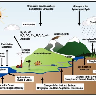

3 Comments